 |
||
|
|
||
Paris![]() 1910 Great Flood of Paris
1910 Great Flood of Paris
What is now known as the Great Flood of Paris started in early 1910. On January 21st of that year, after months of heavy winter rainfall the Seine River started to rise rapidly. The flood reached its height on January 28th and then receded after that. The Seine returned to normal in early March. When all was said and done some 20,000 buildings were flooded as was half the Paris Metro.
What Paris looked like on January 29th, 1910 (view of Paris on January 29th, 1910 and another), postcard of Avenue de Versailles, Rue du Bac and Rue de Lyon during the flood.
Flood markers today.
Great Flood of Paris Then & Now: See what some of the locations look like today.
Suggested reading: Paris Under Water: How the City of Light Survived the Great Flood of 1910
Here are some postcards of the Great Flood of Paris:
Rue de Bourgogne near the Chambre des Députés. See the same view after the water started to recede.

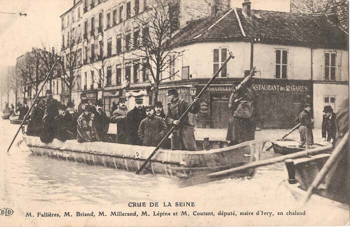
Boats like this were used for transport.
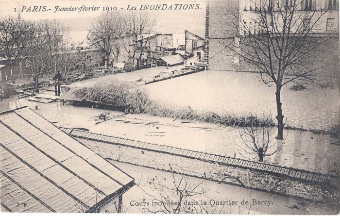
Neighborhood of Bercy during the flooding. Bercy is in the 12th arrondissement of Paris.
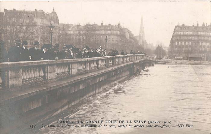
Hightest level at the Pont de l'Alma, January 1910.
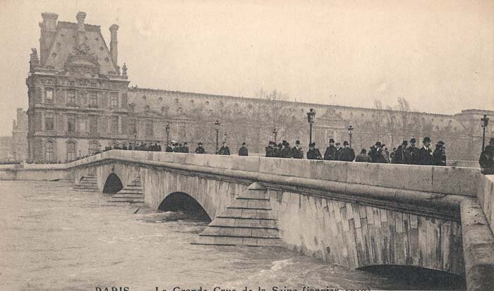
Hightest level at the Pont Royal, January 1910.
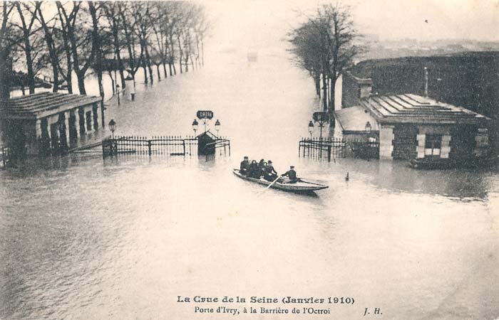
Porte d'Ivry, date of this photo is listed as January 25th, 1910.
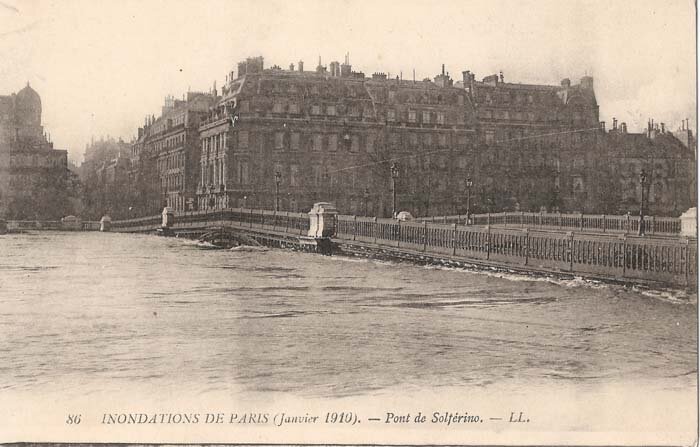
Pont de Solferino, now Passerelle Léopold-Sédar-Senghor.
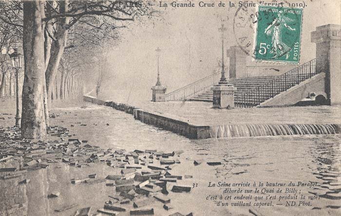
Quai de Billy, now de Billy is spelled Debilly.
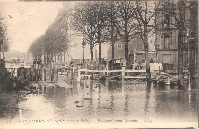
Boulevard Saint-Germain
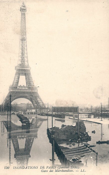
Eiffel Tower & Gare des Marchandises

|
Sign-up for the FREE Americans in France newsletter! |
![]()